July 23, 2018:
Lying in bed, staring into the darkness of our room, I am having anxiety for the day ahead. In only a few hours of sleep and a 2am wakeup alarm, we will be departing for another epic backpacking/climbing trip that I have thrown together in a shorter amount of time than I want to admit. But with the trust of my wife, Johnan, & our friend, Cary, we depart tomorrow on an epic hike of adventure and climbing.
After a sleepless night at Cary’s house in downtown Leadville, we are out the door and make the 2-hour drive over Independence Pass to the trailhead. I’m glad it is dark; Johnan is driving the windy road from Leadville to Aspen. In the daylight, this road would send anxiety coursing through her, and she would pull over for me to drive. Along the way, we eat our PB&J breakfast sandwich that Cary had made us, carefully picking out only the center of the sandwich, and discarding the crust in the Tupperware container. We stop at the park entrance to self-register and pay the $10 overnight parking fee for up to 5-days. This is the total cost of the trip if you don’t count all the new gear we bought. We lift our 41lb packs (heavy by most standards) onto our backs and hike up the road to the restrooms at the trailhead. We empty our bladders and are sent off by the hoot of a night owl sitting guard.
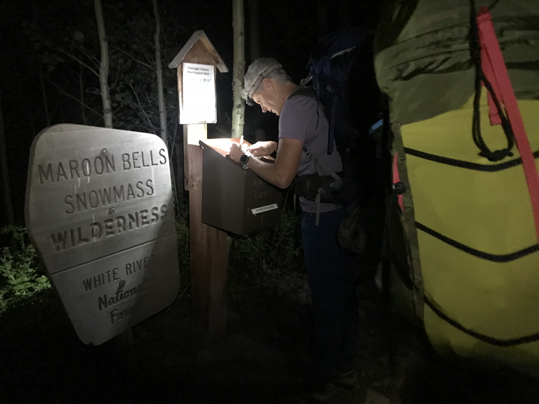
It is 5am as we hug the shoreline of Maroon Lake – still too dark for the obligatory picture of the picturesque Maroon Bells looking down at us. We stop at the trail-use kiosk to register for the free permit and disclose our expected campsites for the next 4 nights.
Our headlamps lighting the way, we bob and weave our way up the trail, climbing the first 1.7 miles to Crater Lake. Along the way, it gets light enough to turn off our lights, and we pass a small group of climbers headed up to Pyramid Peak, a Class 4 climb that I have scheduled for us on final day of our trip. I was a bit jealous. But we will be back here at the end of the week to climb. We continue.
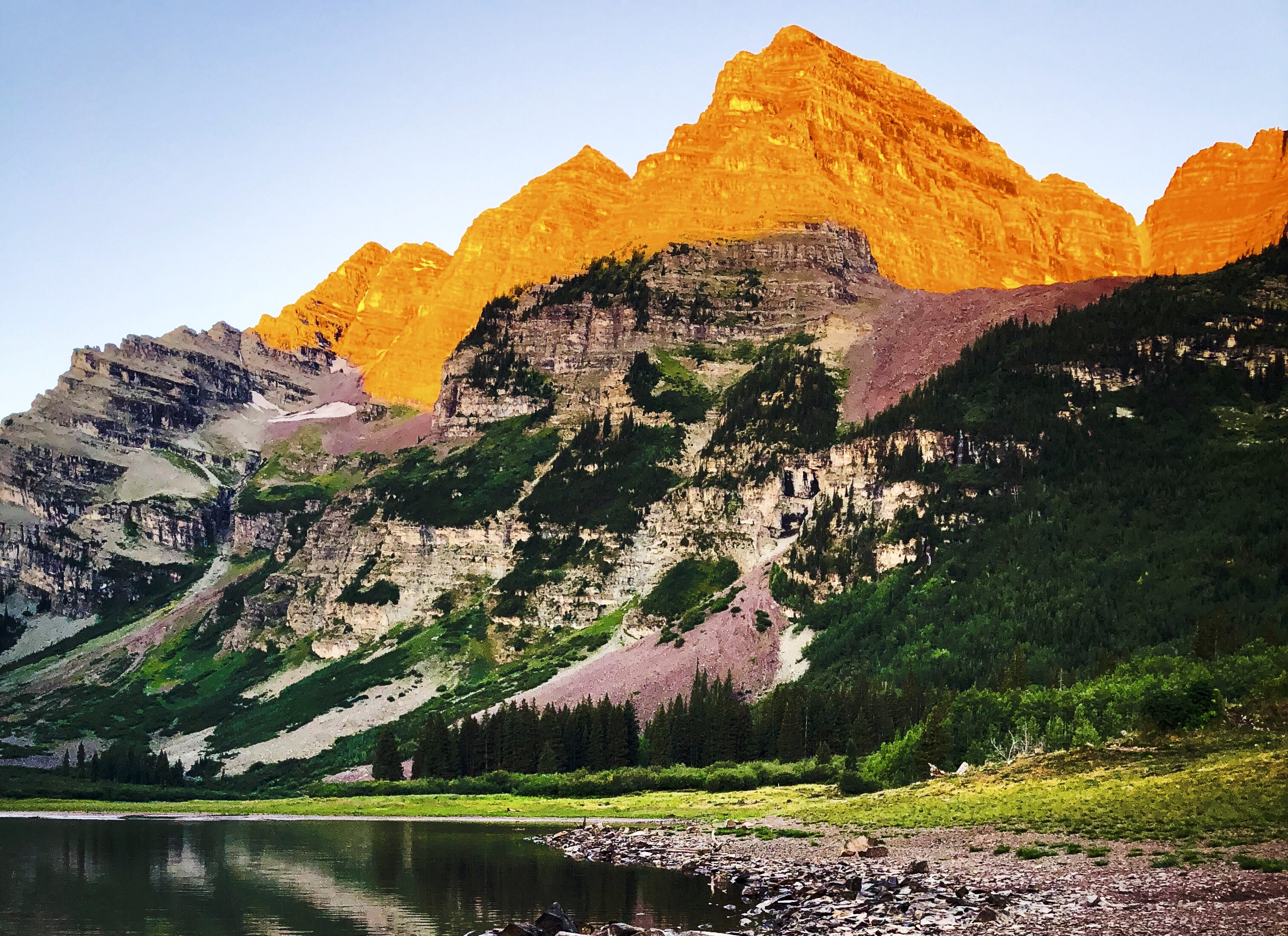
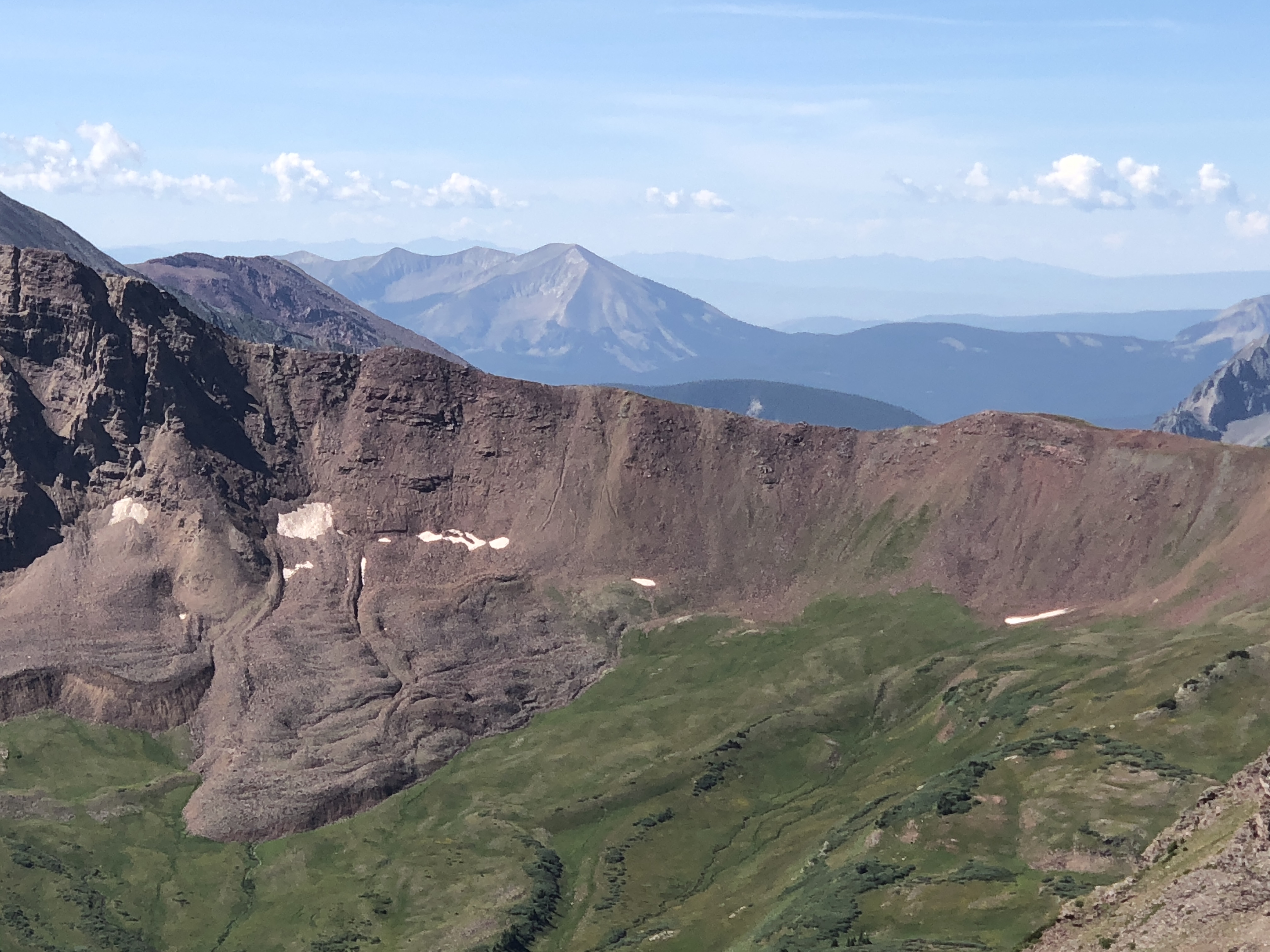
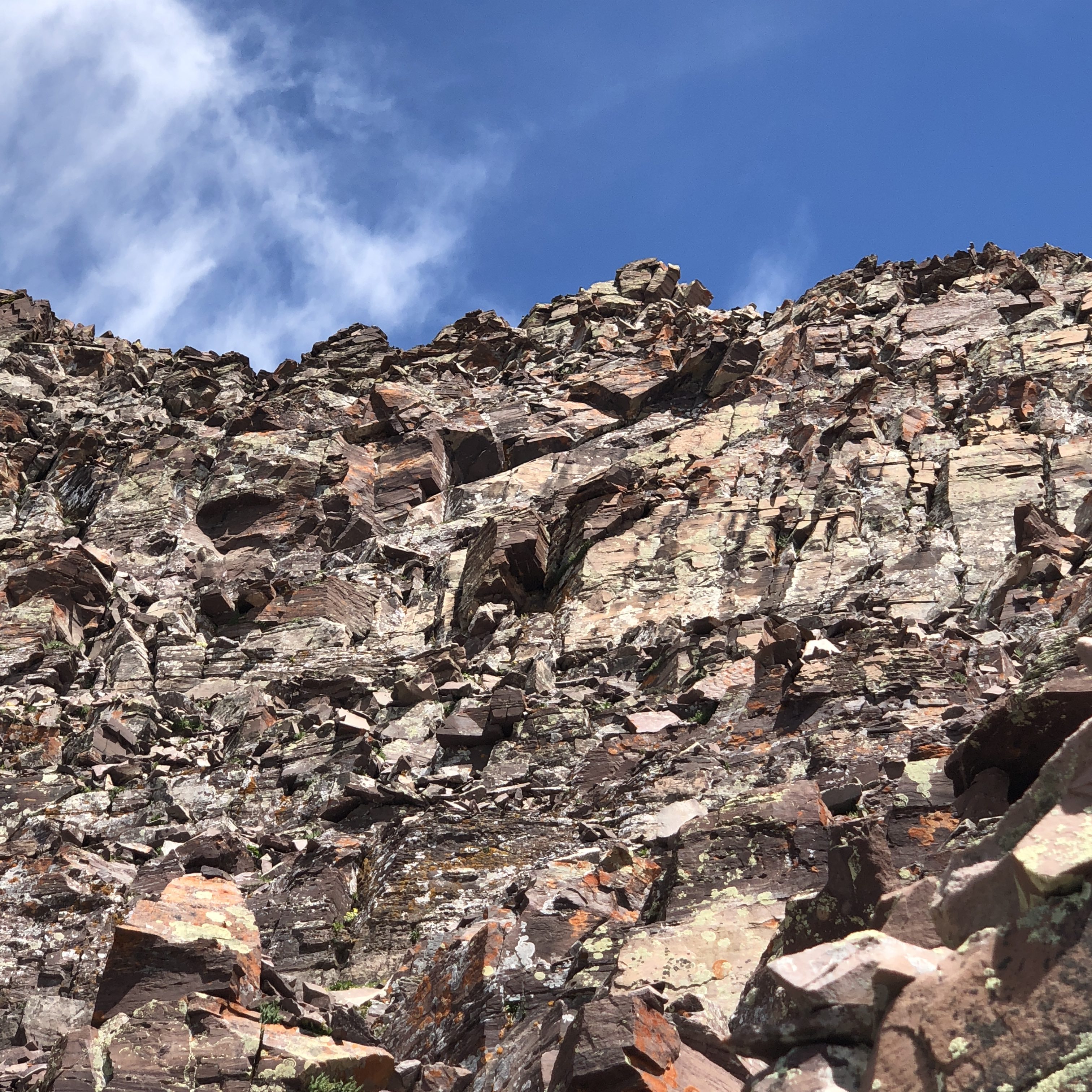
It is 6am now at Crater Lake. The sun is lighting up the red, crumbly rock on the Maroon Bells. It is beautiful, and we stop for the beautiful pictures that fill our lenses. The Maroon Bells, made up of Maroon Peak and North Maroon Peak, are the most photographed peaks in the US. You can see North Maroon Peak in the center, and just to the left is Maroon Peak. They are both 14ers, but because of the distance away, Maroon Peak looks smaller and as if it is a piece of North Maroon Peak, though it is taller at 14,156ft. They are connected by a difficult saddle that you can traverse, if so inclined.
Maroon Peak is the first 14er we will attempt to summit today. A 14er is a mountain that rises above 14,000ft tall. There are 58 of them in Colorado, and though it has never been a goal of mine in the past, I now seem destined to eventually attempt all of them. To date, I have counted 14 that I have climbed, but the more I climb, the more I want to climb and hopefully summit. With each trip we have made in the last few years, I include plans to climb at least one, but often have intentions of summiting 2-3 per trip. Our itinerary includes 3 on this 5-day trip. That means summiting once every other day this week.
Lofty? Yes, in retrospect, considering two of the three are Class 3 and one of them is Class 4. Climbing is ranked by the difficulty of the climb from 1 being easy hiking on a trail to a 5 which is technical requiring ropes and belaying. The Class 3 climb is scrambling or un-roped climbing. You must use your hands most of the time to hold the terrain or find your route. This may be caused by a combination of steepness and extreme terrain (large rocks or steep snow). Class 4 climbing requires handholds and footholds for upward or downward progress. Rope is sometimes used on Class 4 routes because falls can be fatal. The terrain is often steep and dangerous.
We are headed clockwise on the Maroon Bells loop, the recommended direction on the 26.6-mile loop. The theory is that West Maroon Pass (that we will cross first going clockwise) is less steep than Buckskin Pass, so it is recommended you head that direction first with a full pack. Our packs are definitely full! As a bonus, the turnoff for Maroon Peak is along our route.
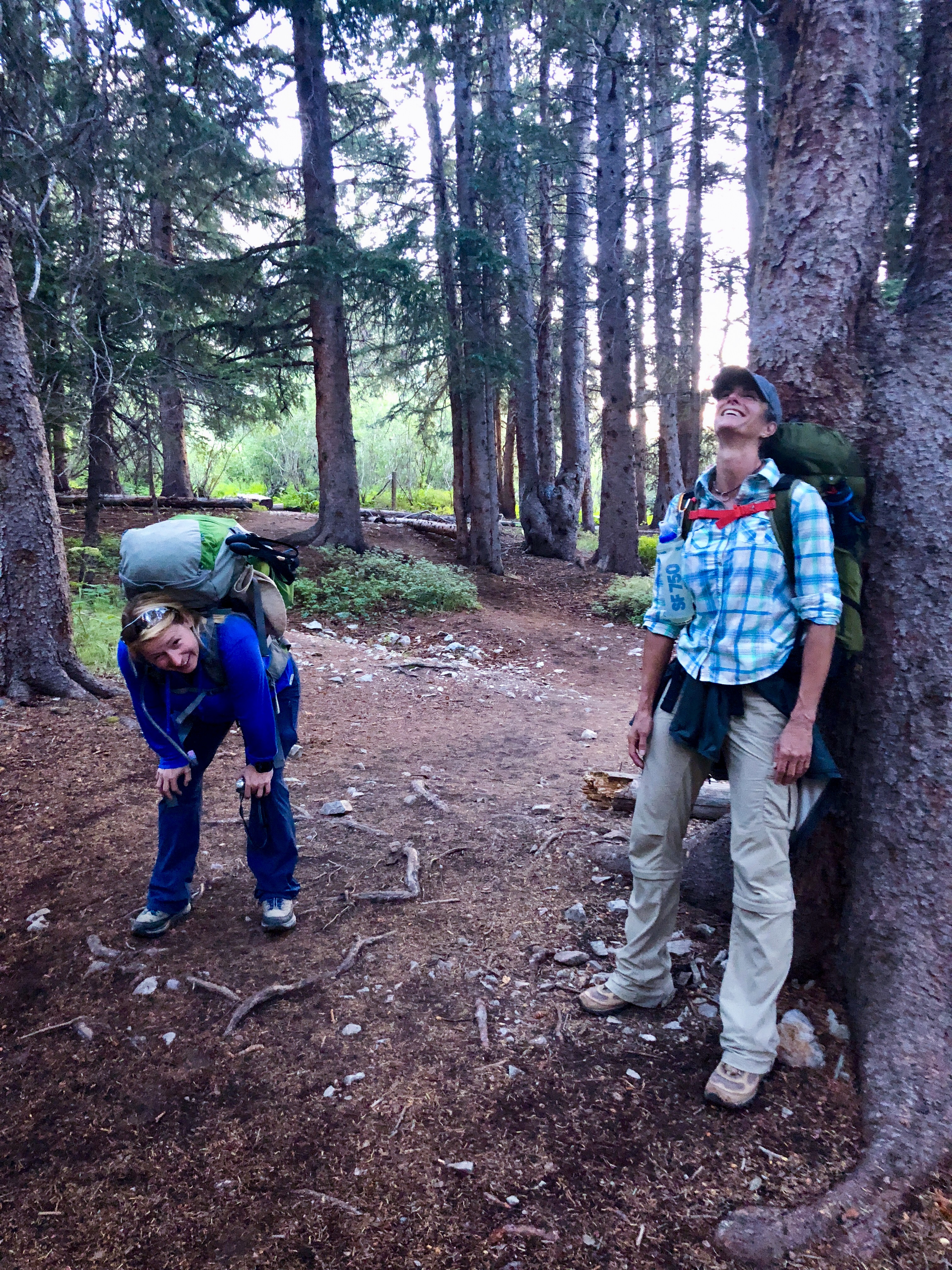
Only Cary and I are climbing the 14ers, so my plan on Day 1 is to find a place to camp somewhere not too far up the trail from our turnoff to Maroon Peak. Just short of 4 miles in, we find a nice spot along the creek (albeit on top of a cliff and a ¼ mile walk back down a steep hill to get water) where a gal is just packing up and says we can have her spot. It is 7:30am, and though it is still morning, I know we are a bit late for a summit bid on what would certainly be the toughest peak I have attempted to date.
Regardless, Cary and I are excited. We put on our lighter day packs and transfer our hydration packs and a few snacks into them along with rain gear, sunscreen, hat, etc. We backtrack .5 miles to the turnoff for Maroon Peak.
We note it is 8am now, a lot later than we both want. A quick glance at our backpacking map shows 1.9 in light grey for this section of the trail. I assume that means 1.9 miles to the summit and 1.9 back from this location, so I am planning on a round trip of roughly 4 miles to get back to this point (never assume, always plot for accuracy). In my haste to pull the rest of the trip together, I did not plot the mileage of this section.
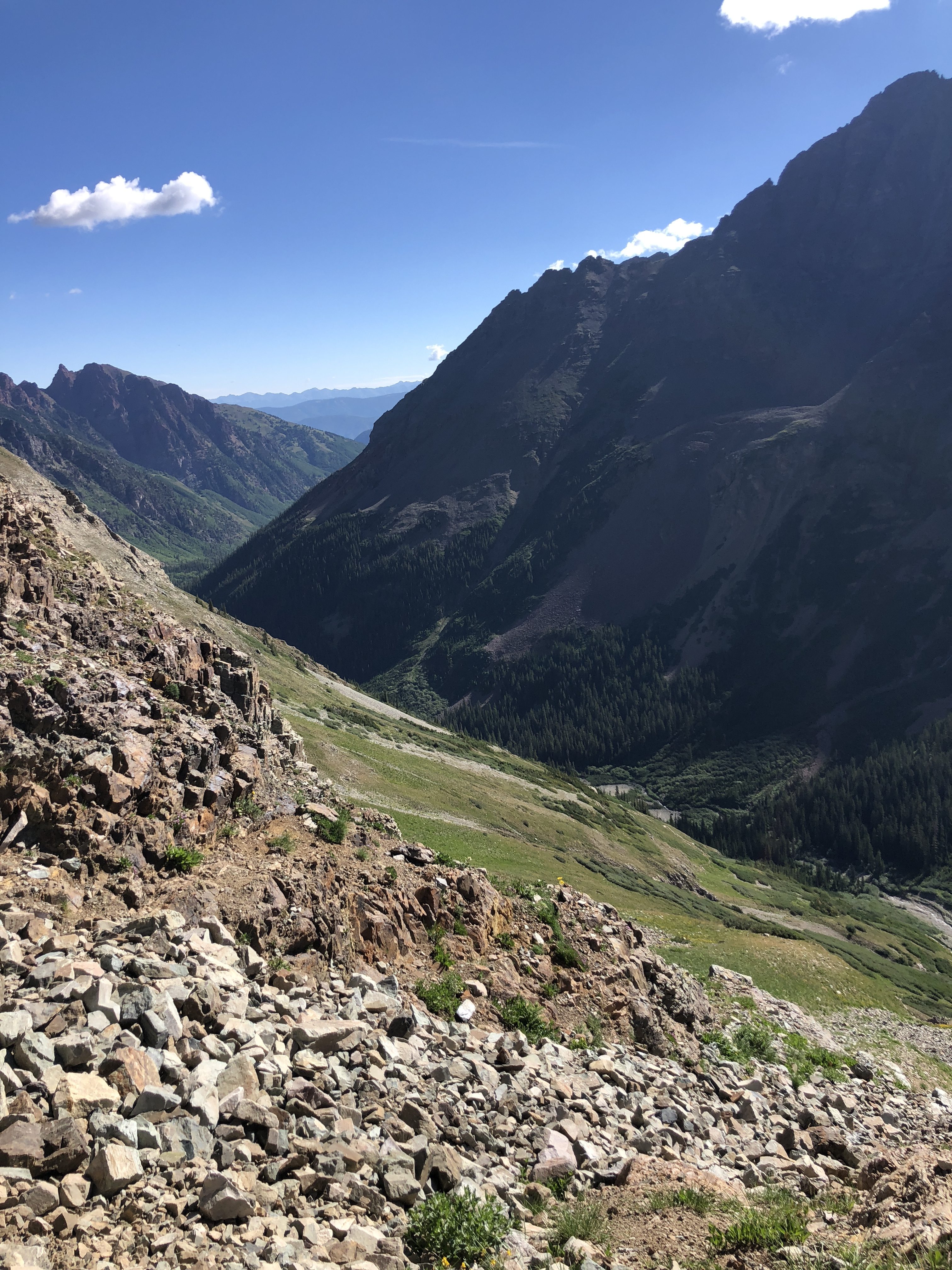
The long slog up the east slope of Maroon Peak is just that, a long steep slog. It is unrelenting. We take 1 step forward and often slide a few inches back. We both agree that east slope would never end and dread the walk back almost as much as climbing up it.
What seems like an hour later, is indeed that, and we are still walking up the east slope. The first mile of the climb takes about 45 minutes, but the next mile takes 1hr 45 minutes, and I tell Cary that is the longest it has ever taken me to go one mile.
Our 1.5 liters of water each now has a questionable life expectancy and I begin to negotiate out loud if it will expire before this climb is over. I am not carrying a water filter in my day pack, because I neither expect the mileage to tick off so slowly nor the distance to be this long, both of which are happening. But the views are becoming more and more stunning, and that aids in our willingness to climb on.
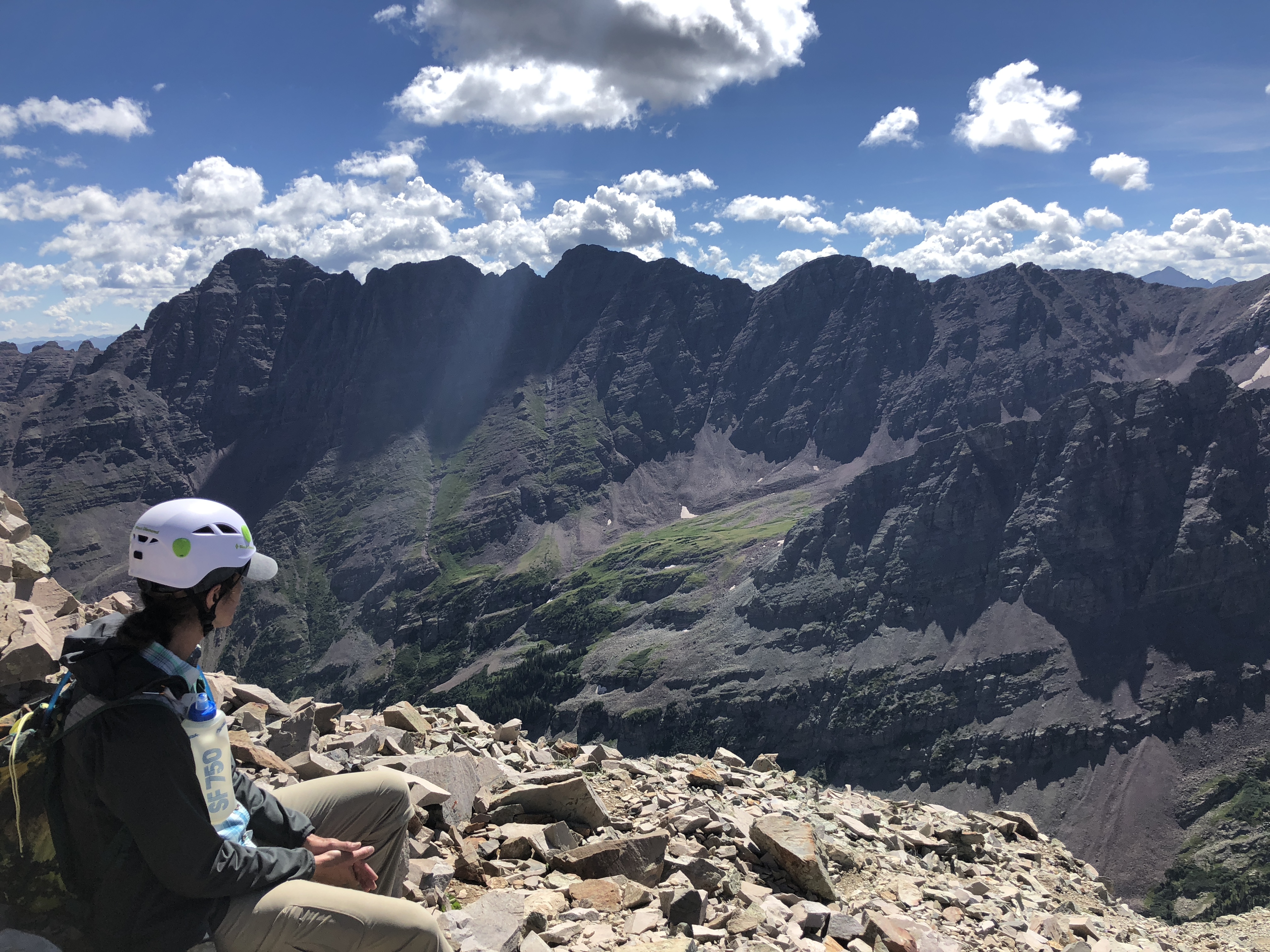
Cary and I continue onward/upward and eventually gain the south ridgeline before dropping off the back side to continue the route on harder more difficult terrain.
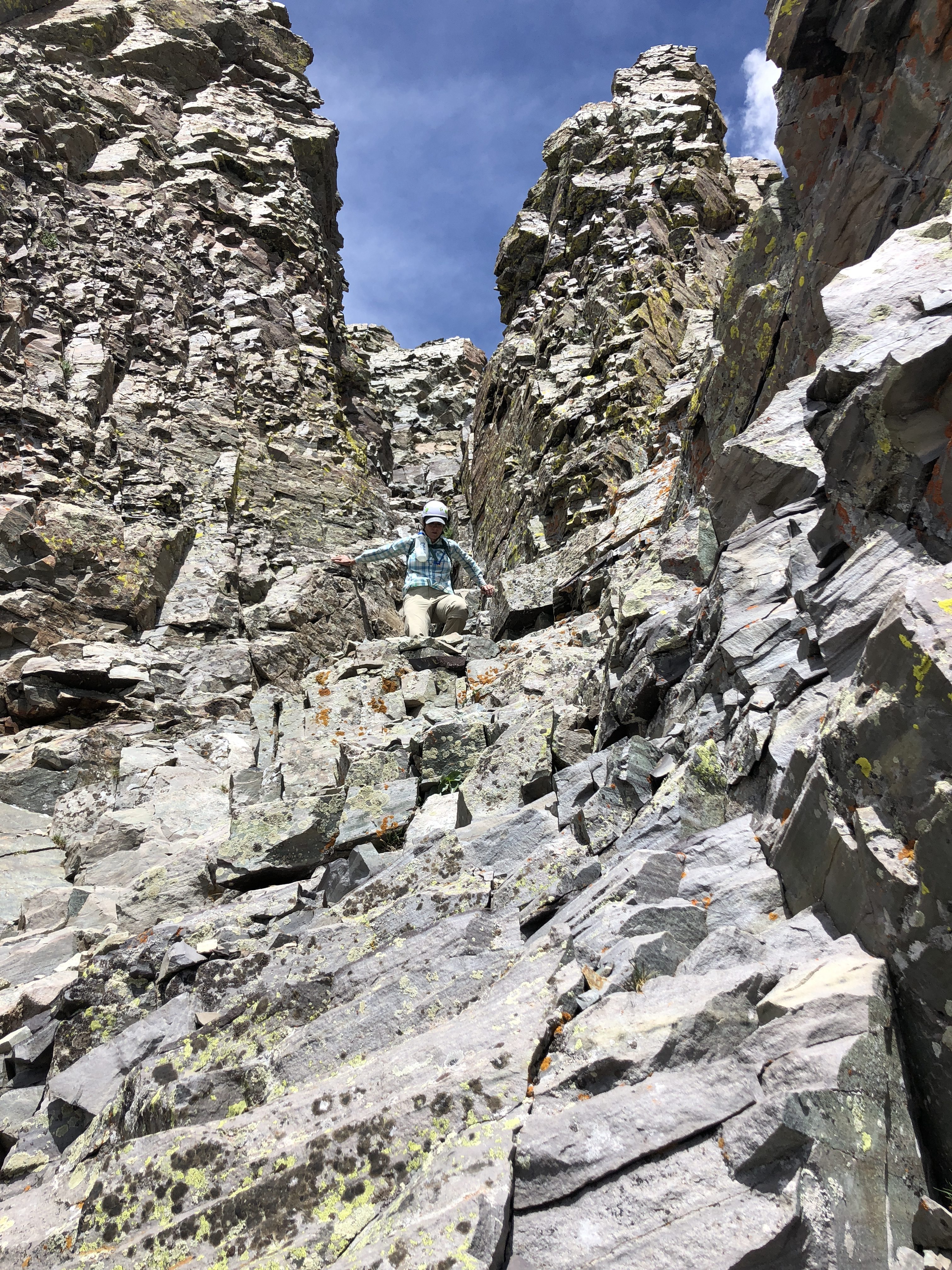
There is a chimney to negotiate, which gives us both a fun and exhilarating climb up, followed by a notch we climb thru and then a daunting view of the remaining route.
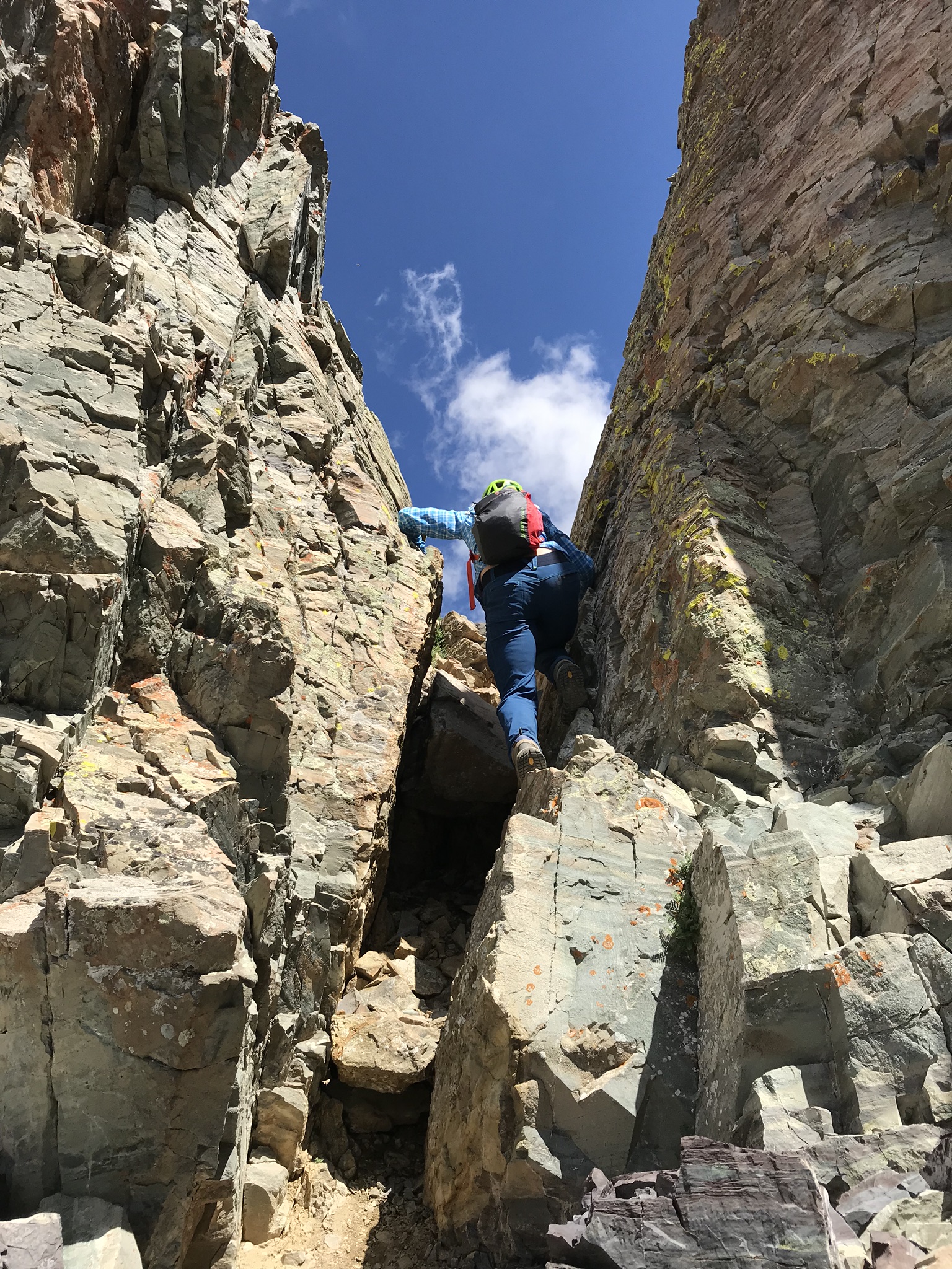
Up the chimney we go…
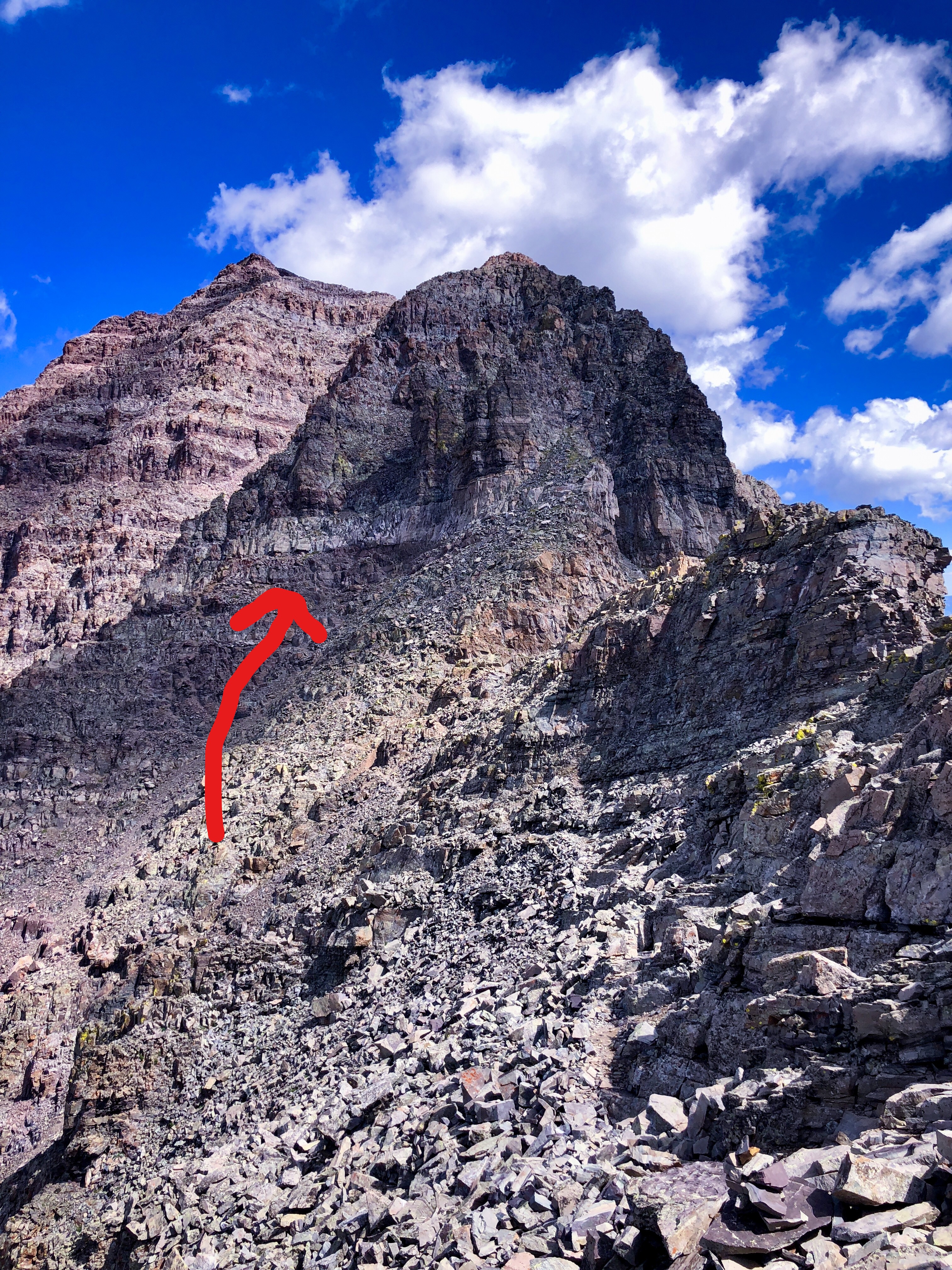
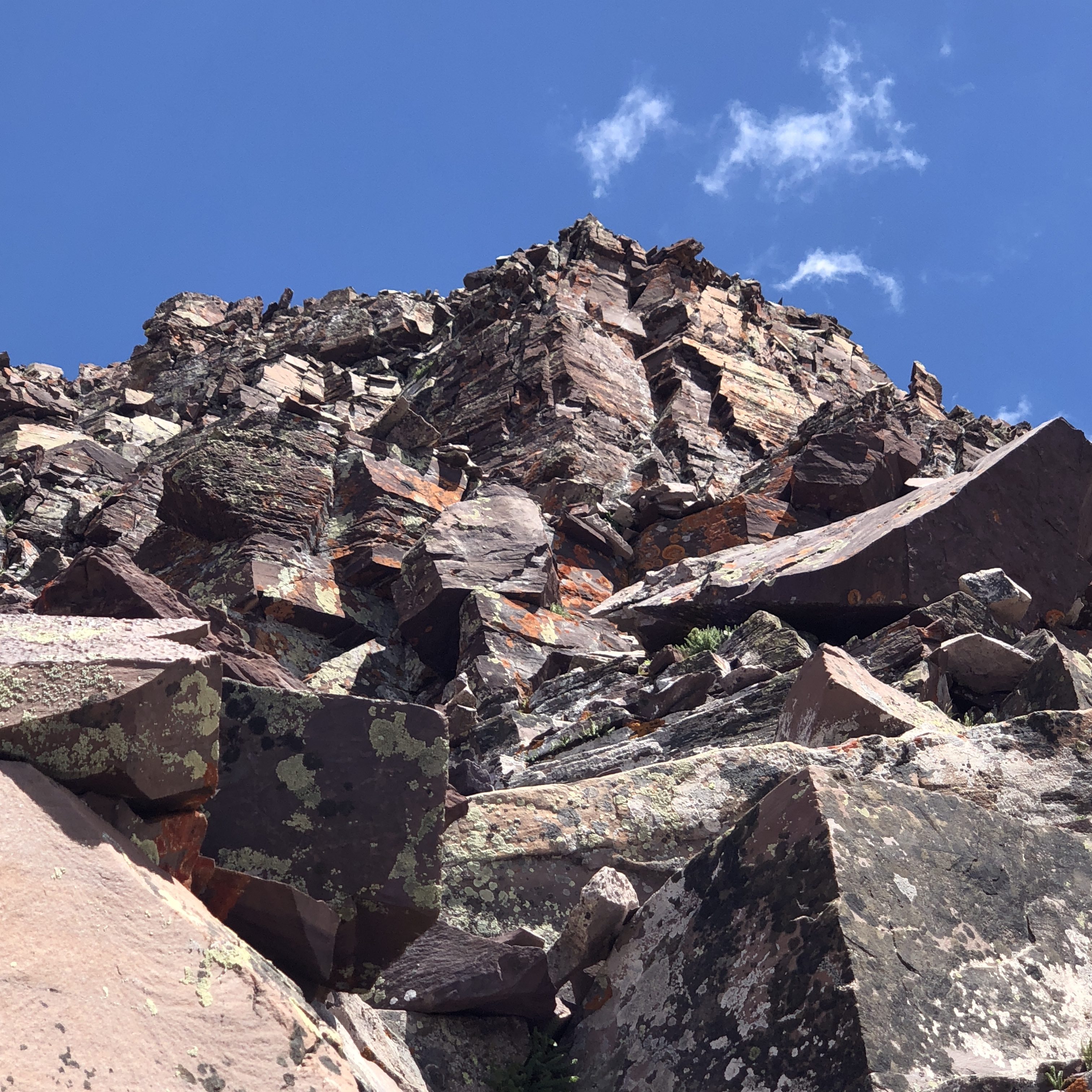
We see the white band of rock we need to climb to, according to the route guide I have downloaded to my iPhone.

We spot the next rock cairn and head toward it.
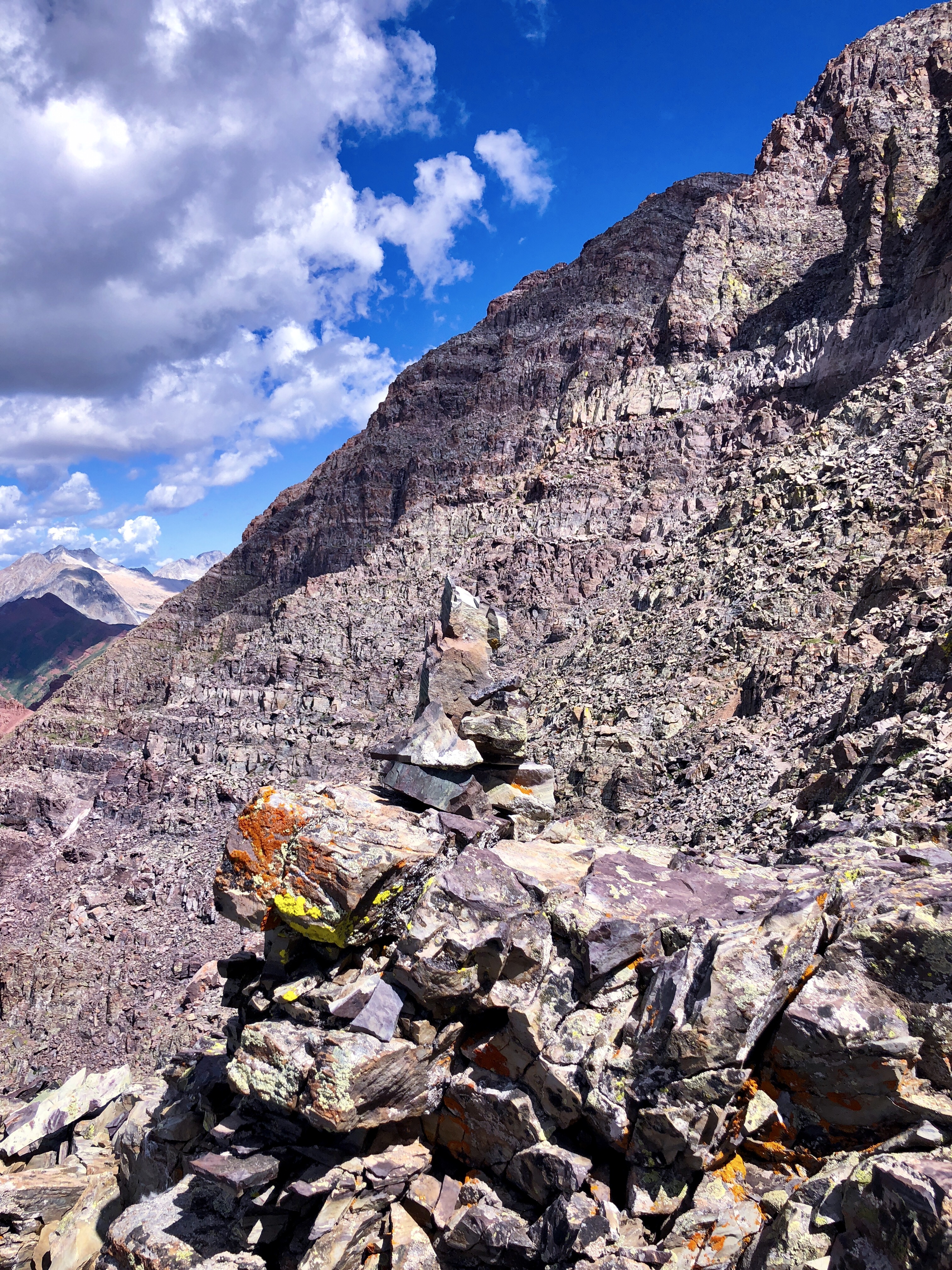
This is one of the prettier cairns I’ve seen stacked on top of a lichen rock outcropping.
Once we reach the white band and round the corner on some sketchy ledges, we stare with much anxiety at the two gullies I read about. They are indeed directly in front of us and blocking our path to the summit unless we choose to ascend them.
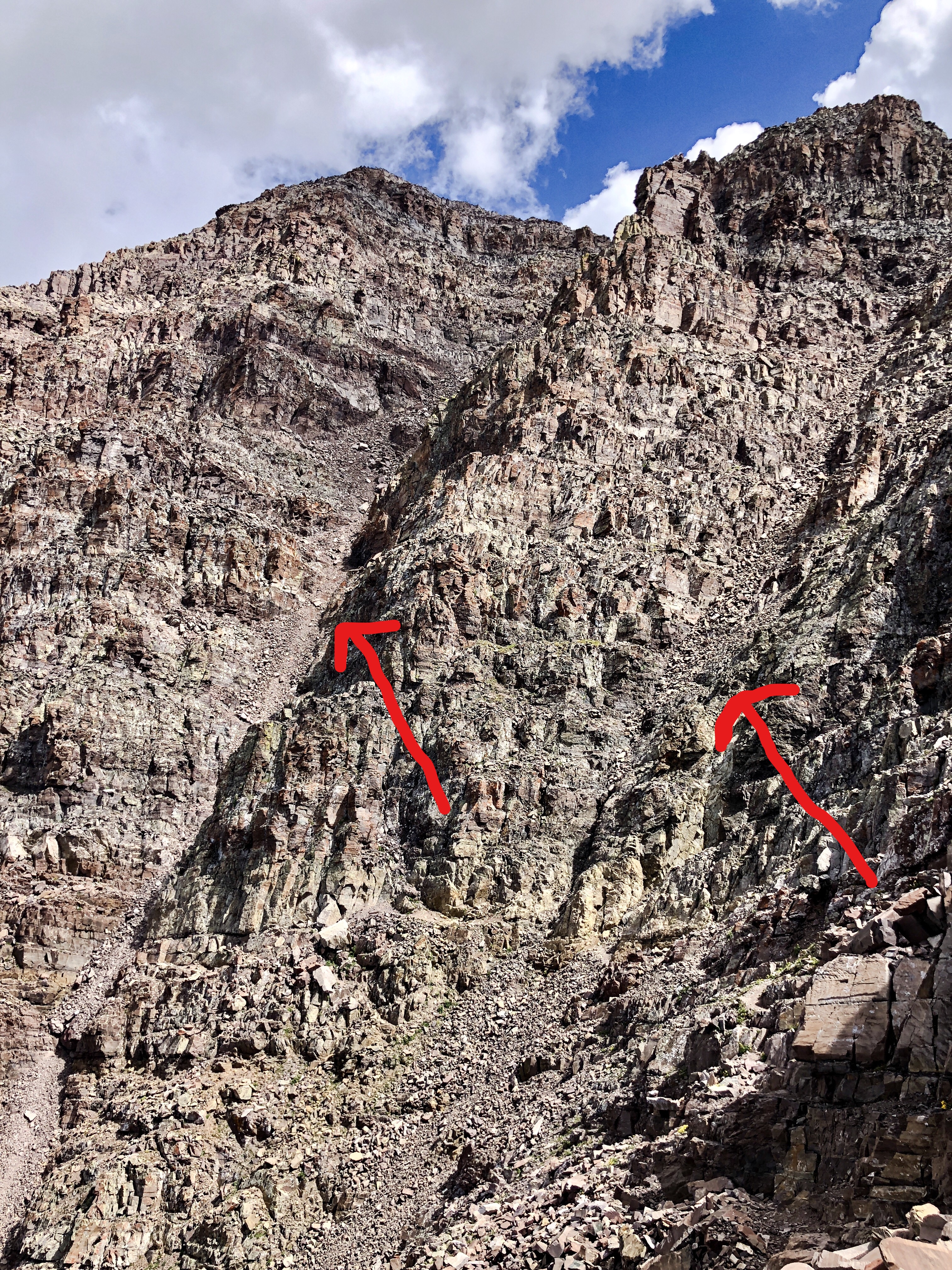
The recommended route is up gully #2 to the left, but either gully is a choice. We sit and study them and tell each other that we can turn around if either of us wants, but we both agree to give it a try. Cary remarks, “Maybe the gully will be easier than it looks.” It is now just after 11am.
Once we drop into the gully and begin to climb, it does seem easier than first glance. However, Cary is above me climbing in the center of the gully, and she begins to slide on all fours as the loose scree moves beneath. Her heart is pounding and anxiety runs high. The sliding stops, and she tells me she is in “vapor lock”. I know that to translate to her “anxiety is at a max level at the moment”. I tell her to get to the side of the gully where the rock is more stable and not sliding. I have no photos in this section, as one of us was vapor locked and the other was clinging to the side of the gully staying clear of falling rocks. There are 2 climbers above us that have already summited and on their way down. They yell at us to ask of if we are coming up. We tell them yes and they wait for us to clear the gully. Once up and sitting next to them, we exchange hellos and they give us advice on the rest of the route. A few of the tips stick in our brains. We are both on information/anxiety overload. I ask how much further (in time) to the summit and it is at least an hour, according to them.
We assess our water situation and share with the two climbers that we are almost out and I ask if that was their two water bottles we had seen down lower and what a great idea that was to stash them there for the descent. They confirm the water is theirs and offer to leave us a bottle because they had plenty. I am thankful, and with that assurance & great looking weather, we decide we can continue our bid for the summit.
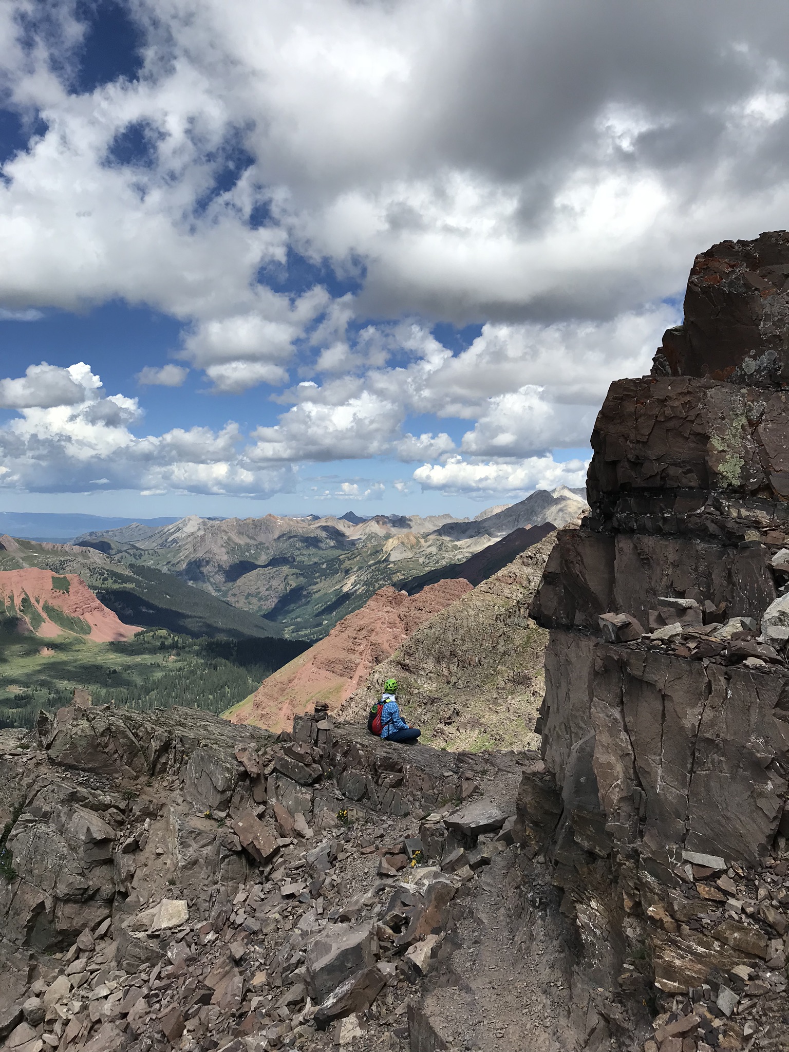
We negotiate a few more ledges and technical route finding, then enter another bigger gully that we climb up and out of by spotting a large rock cairn toward the top of it. We round another corner and now pick our way up through more cairns that seem to be placed at random. We are now at 13,800ft, only 346 more feet to the summit. We find ourselves moving higher on the rock face, then lower as we find other cairns lower on the route. We go in circles a few times on this section trying to make sense of the cairns that lead you one direction only to disappear. We are looking for either of the last two remaining ledges to choose from that will lead us to the last corner before reaching easier terrain to the summit. Sometimes looking at the rock face from afar you can see where you need to be, but when you are on it or in it, it is evasive.
I try one ledge while Cary waits for me and my heart beats rapidly as I carefully test each handhold and foot hold on the crumbling rock, making my way to the corner to peak around. I see nothing but a rocky steep face that looks above our abilities of climbing safely, so I yell back to Cary that this is not the correct ledge. I have no scary pictures of this section either, because my hands were preoccupied clinging to the rock. I slowly climb back to her, depleted of all energy and feeling defeated. It is hard to be so high on the mountain and not able to find the last section of the route. It is demoralizing to know we have just as long of a climb to stay safe and get back to base camp.
I look up again from where we are resting. The weather is great, but it is already after 1pm in the afternoon. It has been two hours since we climbed out of Gully #2. On a normal climb in the Rockies, we should be back in camp by now. Everything in my brain is telling me we should turn around in order to get back safely and not make a stupid mistake. Weather usually comes in around this time.
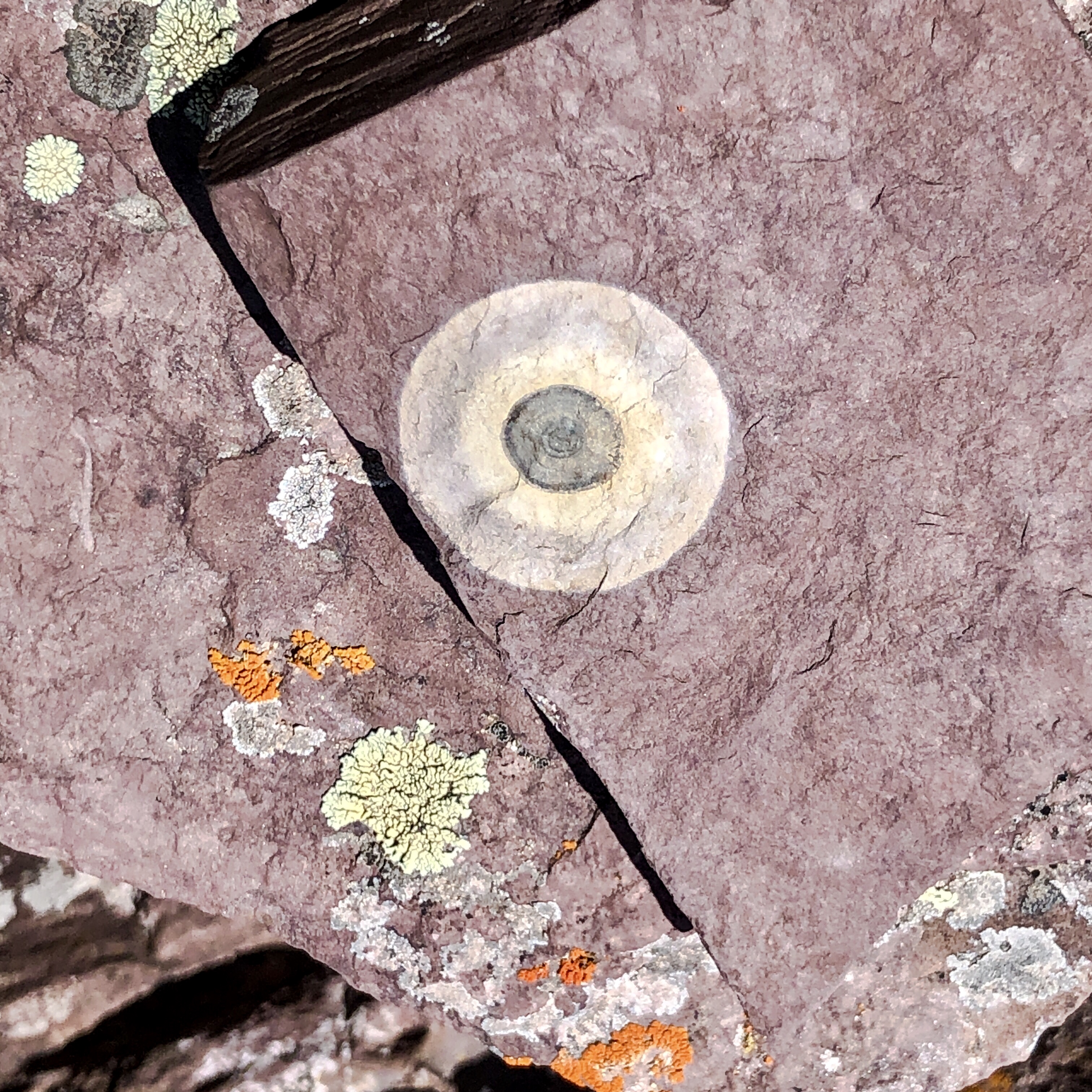
After 3-4 circles at the 13,800 foot line, we both agree that we should turn around. There is a cool feature on the rock I am sitting on. It is a perfect bulls-eye, and in my mind, I consider it our summit marker for the day.
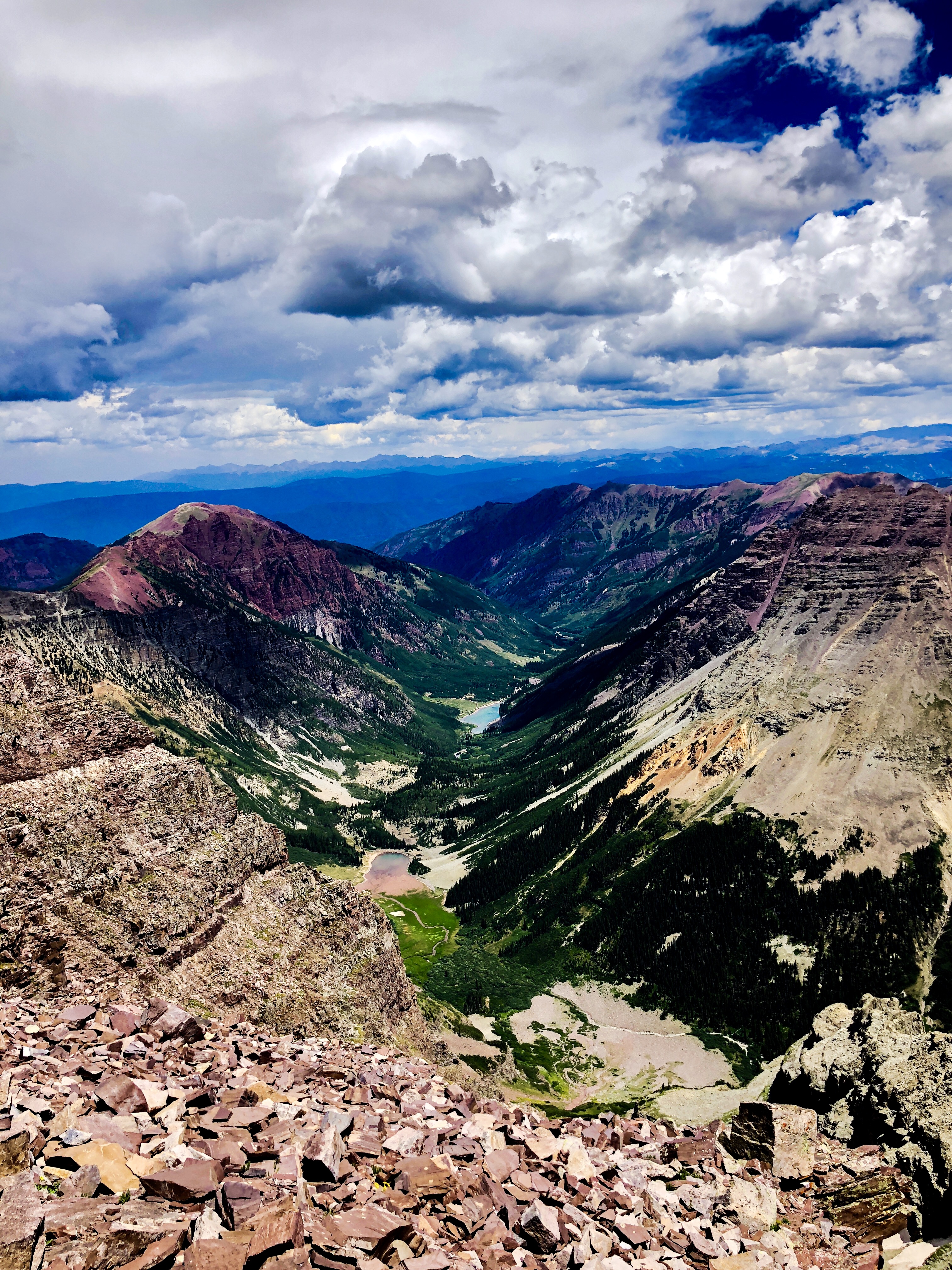
We take a view back down the mountain of where we started that morning at 5am with full packs. You can see the two lakes (Crater Lake in the foreground that we passed at sunrise, and Maroon Lake with the turquoise reflection, where we started in the dark). It is special looking down and knowing that we spent the last 8 hours climbing to where we are now.
We retrace our steps, taking just as long to climb back down as it did to climb up. Our feet are yelling at us.
The steepness of the trail puts pressure on our toenails as we descend. We eventually gain the south ridgeline and find the half water bottle the two men left for us. I am thankful for their generosity in helping us get down safely. We drag into camp at 6pm, and plop into our tents that Johnan has graciously set up for us. I am thoroughly exhausted, but proud of what we have accomplished. In total, we’ve covered 14.3 miles of hard, steep terrain today, and a lot of that with our heavy packs. I feel we climbed safely and both pushed each other to a level we never would have achieved on our own. I am thankful Cary came along to climb with me. She was the perfect climbing partner – testing my threshold for adventure to the max (maybe even to the KatMax). I am thankful for the beautiful weather and no rain. I am thankful Johnan set up our tents and is cooking dinner. We lick our wounds and ready ourselves for the next day. I lie back in the tent with a full stomach, wondering if my toes will recover before morning, and satisfied that I just might sleep tonight.

Leave a comment