9/26/2025 7:00am
Nolan’s 14 was a goal I set out to do in the fall of 2024 and consists of climbing 14 of the 14ers in the Sawatch Range of Colorado (excluding the 15th – Mt Holy Cross, 26 miles to the north of the range). The goal is to do it in one consecutive push hitting all the summits in 60 hours or less. That means taking a more direct route between peaks and often bushwhacking off trail to connect them. My original route was approx 100 miles long and 45,000′ elevation gain. I wasn’t actually trying to make the 60 hour time limit, but rather, just to do the complete line in one go. I stopped after 10 summits and was 67 hours in with an incoming snowstorm on the way, not to mention I was exhausted. (link to that blog)
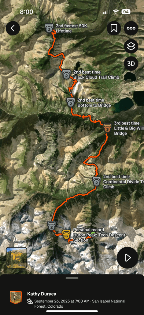
The current plan – to climb the remaining 4 x 14ers in the Nolan’s 14 line, picking up where I left off in 2024 at Clohesy Lake after a tiring descent down Missouri Peak in the darkness. The remaning peaks are Huron Peak, La Plata Peak, Mt Elbert & Mt Massive.
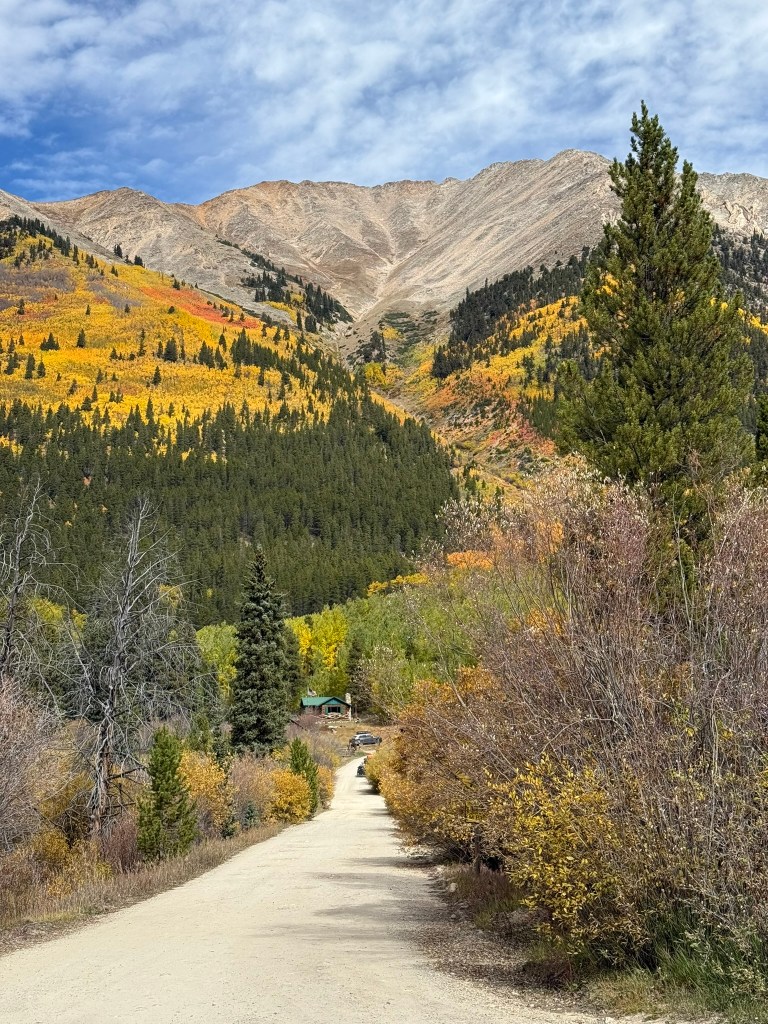
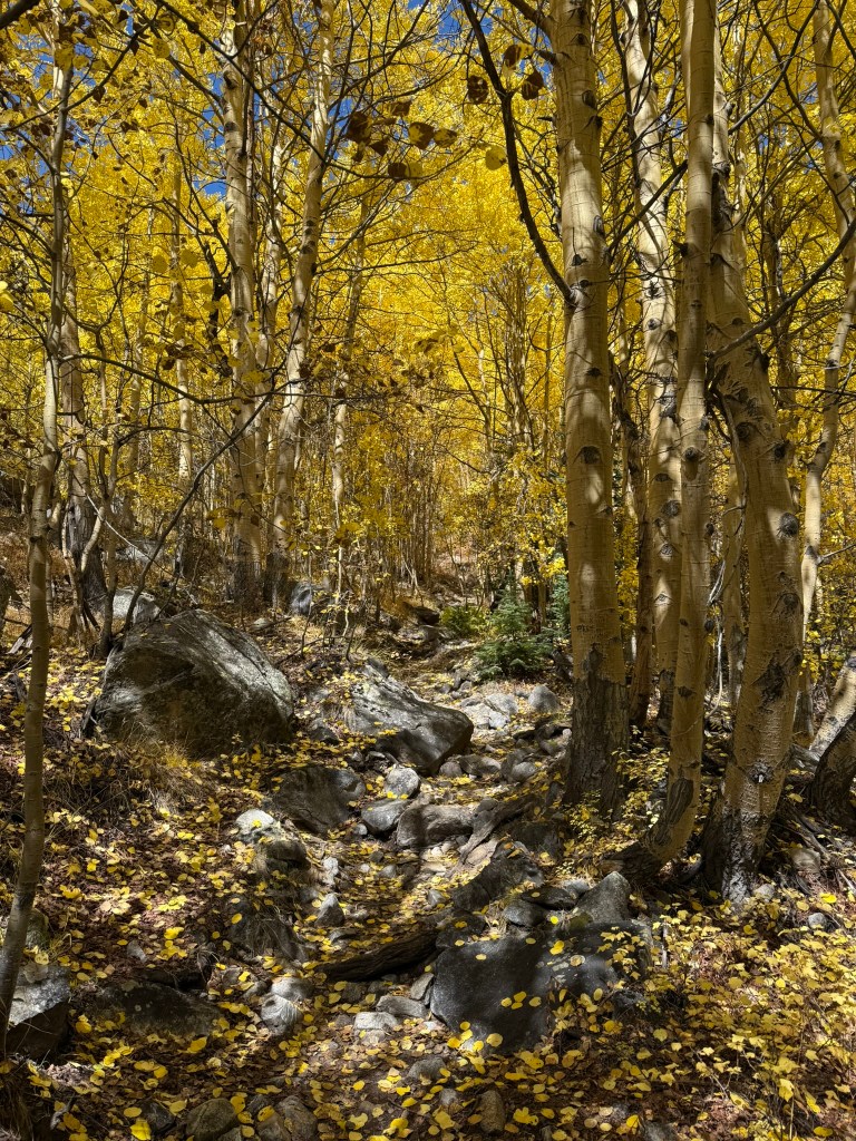
We leave home at 5am and Johnan drives me two hours to the place where I left off in the previous year. We bounce our way up the final 4×4 jeep road in or trusty 2015 Ford F150 to Clohesy lake for a 7am start. The aspens are on fire in the early morning light, and a warmth comes over me for the upcoming journey.
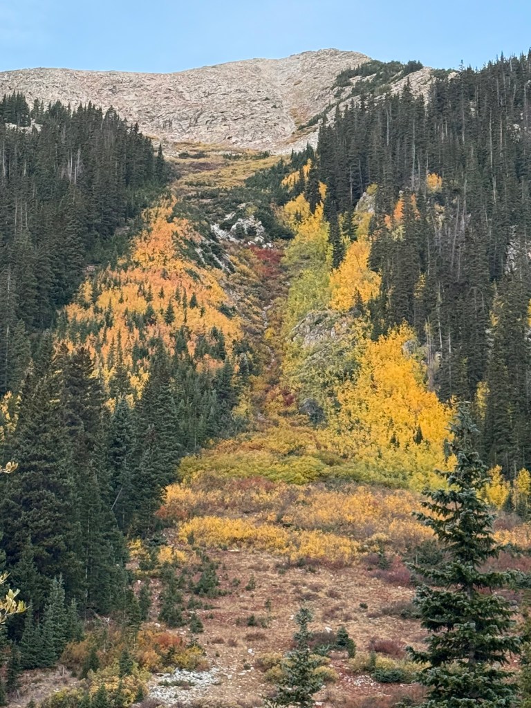
Johnan and our two pups join me for the first 1/2 hour, which is anything but a walk in the park. We cross the small stream funneling out of Clohesy lake to the creek below and abruptly start the bushwhacking section up into the forest. There is nothing really easy about the start from Clohesy lake; the east side of Huron Peak is steep and forested and there is no trail, other than the small game trails that crisscross their way up the steep slope. Once above treeline, I head for the boulder field. This is not a runable section for me, as the boulders are often loose and one miss-planted foot can end in an ankle roll. The morning sunrise reveals a bluebird sky, and even though I seem to slide back 3 inches for every foot I take up the loose scree, I eventually arrive at the saddle and make quick work to the summit.
There is one couple at the summit having a breakfast snack. We greet each other and take in the beautiful views of all the aspens below in full color change. I turn to head down, making my way past several groups of hikers who have come from the main trailhead on the west side. I’ve completed Huron 5 times now, and I am able to descend my fastest time yet, taking a more direct line once I hit treeline, leaving the main trail and descending along the creek.
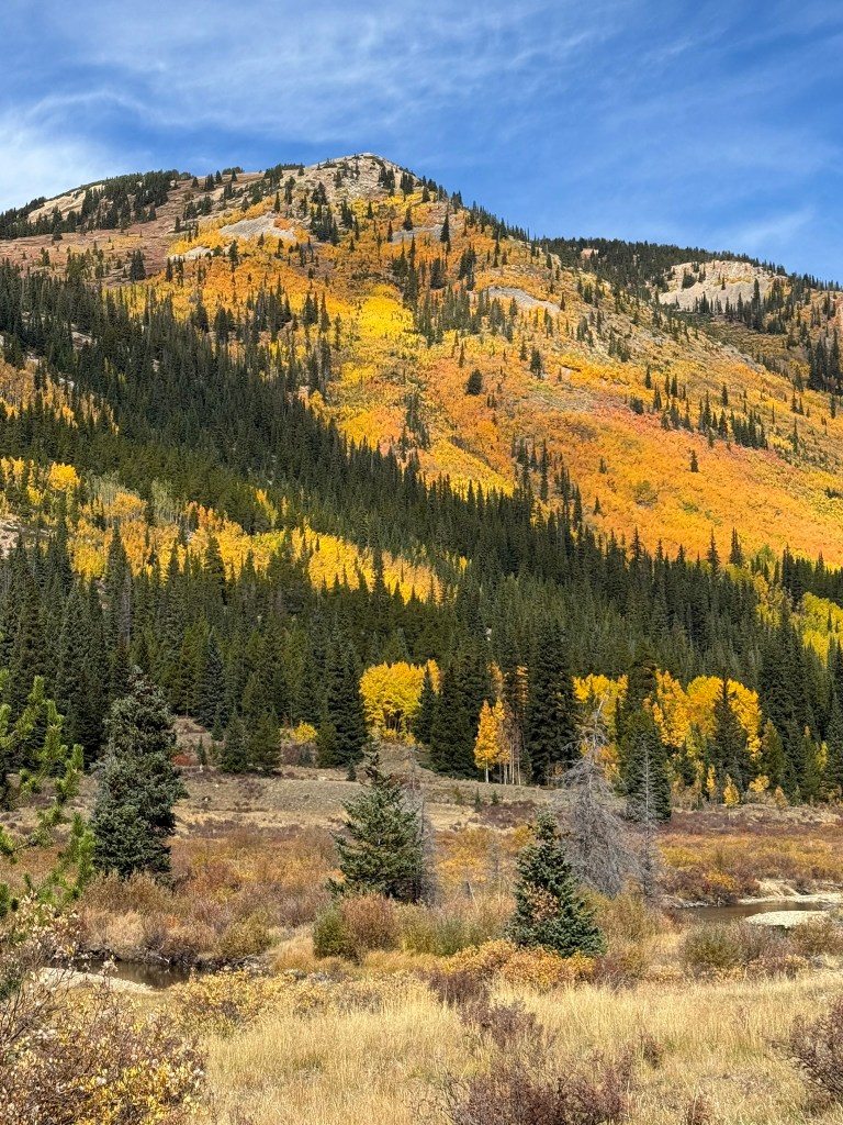
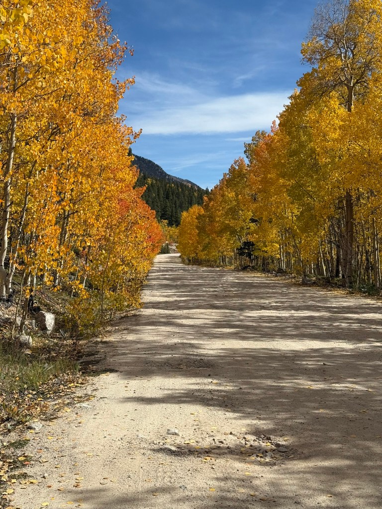
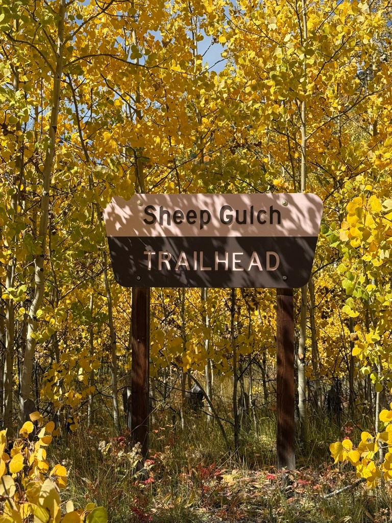
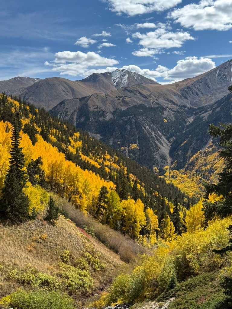
I now have a 4 mile run from the trailhead marker to get to Sheep Gulch, and running down through all the wonderful colors in full display of their fall foliage makes this one of my more memorable runs ever.
Time passes quickly and I arrive at Sheep Gulch an hour and a half ahead of schedule. My spirits are high.
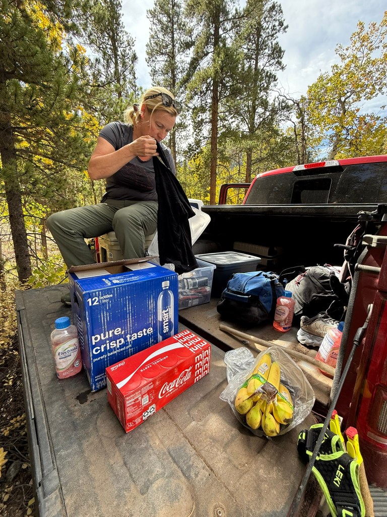
Johnan and the pups greet me; Gracie lets out a happy wine and Howie is focused on a chipmunk, twitching his nose to the movement of the tiny critter. I replenish my nutrition in my pack that Johnan has ready for me, swap out my paper map (a backup to my Gaia GPS app) for the next leg, chug a pedialyte drink for the extra electrolytes, grab a banana for the trail, and off I go.
It is another steep start headed up Hope Pass. The first few miles seem to last forever because I am moving so much slower up this pitch. My stomach feels a little queasy, but I attribute that to how quickly I drank that pedialyte drink. I keep moving though, because I know forward movement will eventually get me there. I carry the banana for a few hours before finally finding the ability to eat it.
The colors are so spectacular as I glance back down the valley where I came from. The golden leaves are contrasted with the deep colors of the evergreens. It’s eye candy to me and makes me feel happy.
Soon, I leave the trail and traverse across the slope toward the ridgeline that will lead me to Mt. Hope. This mountain is 13,939. It is the closest to a 14er near La Plata Peak (which is temporarily closed due to a wildfire on the north side). There isn’t really a distinct trail once you near the last two false summits, so I just put my head down and pick a line threw the rocks.
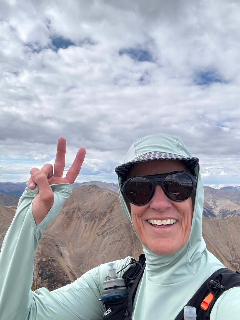
Frosty balls along the way greet me every few feet upward. These amazing plants look like frosted balls, (a bit alien like) and they thrive in this environment near the 14er summits. It is usually during the last 1000 feet before the summits where i see them most. Once over the last false summit, the top of Mount Hope is clearly visible, and unimpressive on the final summit mound as compared to other peaks with jagged tops.
Standing there, I see the ridgeline I need to travel down before angling off toward the northeast and dropping down to a lake. Instead, in the moment, I decide to start my descent immediately. This line looks quicker on my map. But 500′ down my descent, I am sharply humbled with one of many moments to come. This was not a good line. The rock is crappy and loose and descending is slow, in fact much slower than the ridge line I had scouted a few weekends prior.
Here my choice is to climb back up and follow the known ridgeline, or continue down and hope it gets better. If you know me, you know I hate going back the way I came. So downward I descend, until another 500′ lower, I realize I’ve still made the wrong decision and it hasn’t gotten any better. So now live with it, or climb back up 1,000′ and follow the ridgeline.
And so it went, every 500′, I reconfirmed to myself that I had gone the wrong way, but I continued down, seeing in the distance below what looked like a scree field (which I love to descend in). The scree contains much smaller rock and dirt that you can actually surf on with just your running shoes. The rocks I am in now are bigger and looser, and one wrong step can easily result in an ankle rolling injury.
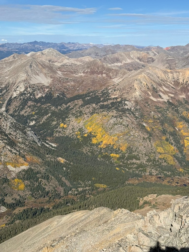
Looking back on this terrain from some aerial shots from above, I realize why my legs were so shredded that day. The gully I came down was a loose, boulder strewn landscape contrasted to the beautiful Hope Pass Trail descending the soft tundra to my east. Somehow, my brain had decided that Hope Peak, some 61 feet short of a 14’er, was in no way similar to a 14’er, and that I would make quick work of this substitution on my route. But in reality, it was every bit as hard as a 14er, and arguably harder than many of them.
At last I make it to the beckoning lake below, only to be disappointed as I found myself sinking in the marshy grass surrounding it. I move outward on the perimeter to escape the marsh, but it extends even further than I imagined. Keeping my feet dry is a high priority; I don’t do well with wet feet as it softens my skin and invites blisters.
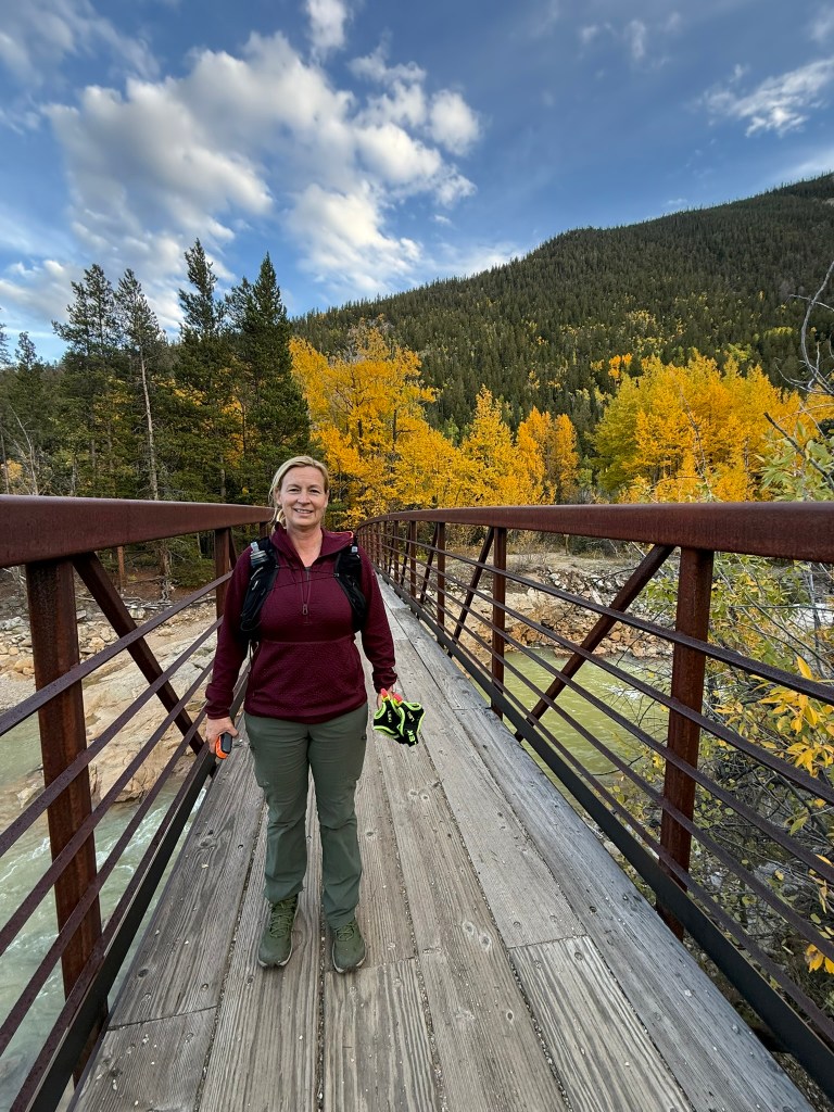
My mind was on the timeline I had created in an excel spreadsheet for Johnan. I wanted to stay ahead of schedule. My legs were now spent from that “not so great of a line descent” and so I shuffled (not sure it qualified as a jog) slowly down the trail toward my rendezvous point with Johann and the pups at a bridge below. They were there to greet me, and Johnan had a mini coke to give me. That was unexpected and welcomed!
The dogs played and frolicked the last mile down the trail to my aid stop, and even though I was beaten down a bit, I was still an hour ahead of my timeline. I changed clothes into some winter gear for the upcoming 12 hours of darkness. Johnan gave me a burger she had picked up in Twin Lakes and it was surprisingly still warm as I sunk my teeth into it.
I moved all my gear from my smaller Salomon pack to my bigger waterproof pack to carry my cold weather gear. I had three layers for my torso and two for my legs, and two thicknesses of gloves, two headlamps and all my normal stuff as well. I tucked my half eaten burger into my hip-pack, grabbed two cookies and we headed out. Johnan and the pups joined me for the first mile headed up a side road through a campground closed for the season. We had the beautiful aspen lined trail to ourselves and chatted about the day.
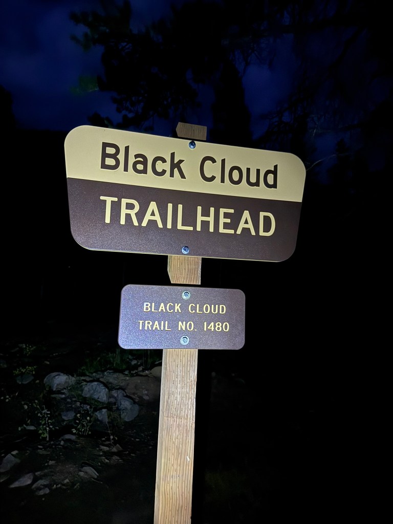
They went as far as they could in the campground before turning back, and then I was alone, heading into the darkness up Hwy 82 toward the turnoff for Black Cloud trail (the steeper way up Mt Elbert). Darkness had settled in, and I jumped on and of the highway as cars approached and passed by. The Black Cloud trailhead brought relief, and doubt all at once. Relief for being off the short section of highway, and doubt about the darkness I was stepping into.
Johnan had driven into Leadville before the last aid stop to get me a new headlamp. I wasn’t feeling good about my backup light being able to have enough power to my descent off of Mt Elbert in the darkness. Of all the things I worried about, that was the one I was afraid of most. It was a moonless night, and the backside of Elbert is not a trail. It is not a place I wanted to end up stranded and hurt, and so I worried.
I wore the new light on my head, but didn’t turn it on so I could save it for the descent. Instead, I used my trusty Ultra Spire waist light and turned it on low, knowing I was currently on a non-technical uphill trail and had 12 hours of darkness. I predicted it would be a minimum of 4 hours to the summit of Mt Elbert, another “mistake” I made in taking my scouting time of 3:30 and adding 30 minutes. In retrospect, I probably should have doubled that to 6 hours, because that was what it took in the state I was in. I don’t think I could have climbed any slower than I was climbing.
The only people I came across in the darkness was a couple that was descending down Black Cloud sharing a light. It looked like an iphone light he was holding. They said they had started late and asked me how far to the bottom. I told them about a mile to 1.5 and they were depressed. I asked if they had everything they needed and they said they did. I had bigger things to worry about, namely how much further it was to the top for me. But I didn’t share my down feelings with them, and marched on up the trail.
My stomach was queezy again and I didn’t feel like eating. I took one bite of my half eaten burger, and it was hard to swallow. I tried peanut M&M’s and the stuck in my throat. I drank as much as I could but my Maurten drink mix was getting hard to swallow. I carried one flask of water and drank it often by itself. It was all that tasted good right now.
It was nearing my normal bedtime at this point, and my mind and body began to tire. Here is a dialog form my Garmin messenger communicator between Johnan and me of what was going through my head as I climbed into the darkness:
8:08pm Me: It’s awfully dark and lonely up here at the moment.
8:15pm Johnan: The clouds aren’t letting much light through. I just grabbed our pizza and I’m heading to half moon.
8:29pm Me: I feel so far away from there right now
8:43pm Johnan: You’re closer than you think
9:08pm Me: Man, I’m all swerving and feel like I did the night I walked down off Missouri. I’m having a super low right now and feeling like a common mortal and it’s dark, very dark, and I’m just getting to treeline from what I can tell but yeah, super lonely.
9:22pm Johnan: Made it to the trailhead for Mt Massive. It took me 3 trys to clear that one spot.
The nights are the worst.
You can make it through this one.
I’m sorry babe. Take a few deep breaths.You looked strong when I left you and there’s another strong feeling just ahead.
Only 9 hours til dawn.
9:40pm Me: Ugh, I’m fighting some sickness right now. I am having trouble eating. I’m sure I’m just low on calories but I don’t know what to do other than stop and sit and rest and try to eat, but then I’m not making any progress so the shadows are creeping me out. I gotta get out of this scrub brush.
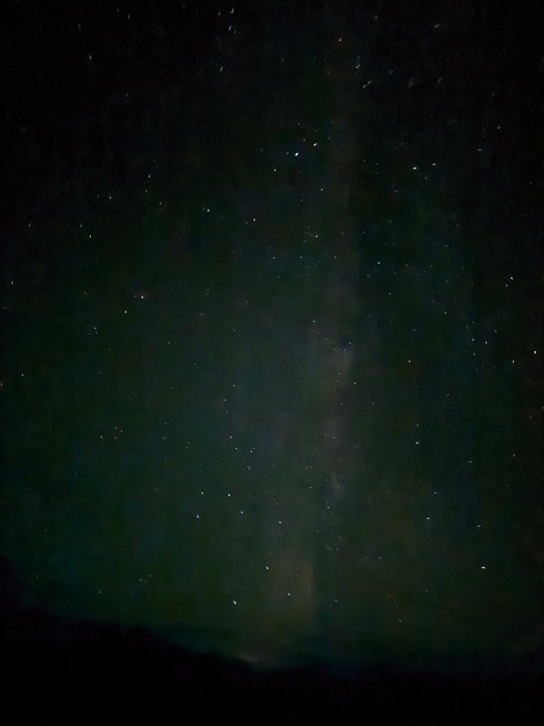
9:55pm Johnan: You got this babe and I got you. The stars are stunning.
10:22pm Johnan: How are you doing?
10:56pm Johnan: I haven’t gotten a message. It is 10:50pm.
10:58pm Me: I’m freezing. I’m trying to stay warm, but my hands are numb. Hard to use my phone. I guess I’ll keep going and hope I warm up.
11:16pm Johnan: It’s weird not receiving any messages – can you check in?
OK, thanks for update, I wish I could help. I’ll try to check in 1 hour from now.
11:18pm Me: Sorry, I’ve got one more layer I can put on so I’m gonna try that because now I’m shaking. I’m hiding behind some rocks. I’ll give you an update as I get further.
11:26pm Johnan: you have to move to stay warm. I’m not sure how I can help.
11:27pm Me: You can’t, but I just got my clothes on and so I’m going to start moving again. Love you.
Oh poo, I just wanted to give you a ping.
So much negativity on this leg. I don’t know that I can overcome it. I’m already thinking in my mind how Gracie and Howie need to move over in their dog beds and let me lay down when I get to truck. I feel pretty awful. I’m still heading up hoping I can survive the scree field when I get there. This is getting beyond type 3 fun so it’s just not that fun right now.
12:11am Me: I’m getting no where fast. I feel like you on Mount Shasta. Step 1, 2, Step 1, 2. That’s all I can do right now.
12:30am Johnan: Love you. Do you want to try and go back down Black Cloud?
12:30am Me: No. I am 500′ to summit.
12:35am Johnan: OK. Remember the plan. Keep moving.
12:36am Me: Yes, moving, but slowly, oh my God.
12:39am Johnan: Try the mental gymnastics you do when you’re doing these big adventures. We want you to crush this challenge. Keep going.
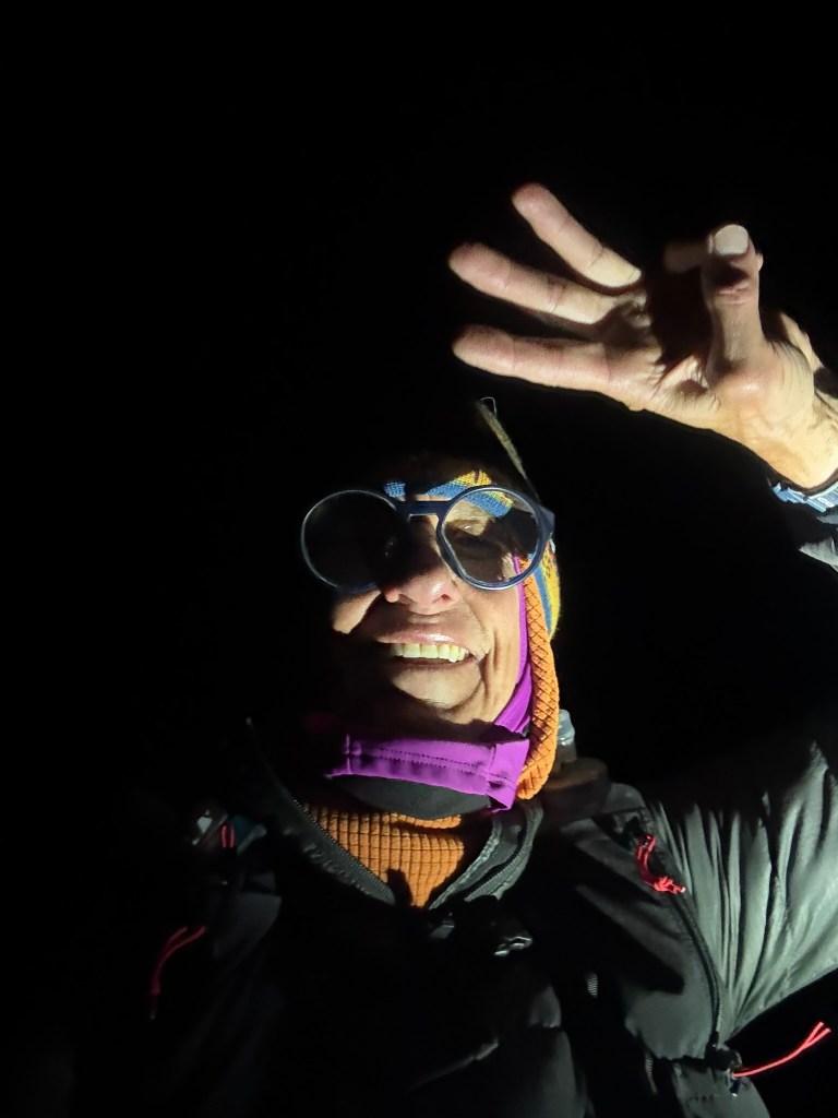
1:23am Me: I am at the summit of Mt Elbert and I’m going to try to come down now.
It has gotten really windy and I’m talking in slow motion because my mouth is frozen.
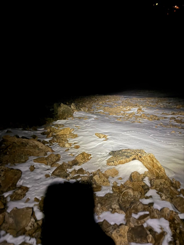
An there is a lot of snow and ice up here so if I get over to the saddle, well, I’m just going to go over the saddle and see.
F***ing snow.
OK, there is some sketchy snow coming down, but I am committed now so I keep thinking when I get down to the saddle and drop down the scree that hopefully it will have melted. but it hasn’t yet, but I’m not there yet.
1:53am Johnan: How are you?
1:55am Me: Spent.
1:56am Johnan: OMG get off the mountain and be safe
1:59am Me: Trying to, going to need a long hug.
2:03am Johnan: This sounds terrible.
No, it’s not going to melt. You need to think safely.
2:12am Me: Getting big tons better.
I’m below the snow and ice now and about to make a left turn to descend the scree field.
Just slip sliding away up here.
2:51am Johnan: How is it now?
2:54am Me: In the gully now toward bottom of scree, but it’s hard to walk on these loose boulders.
3:02am Johan: Please be safe
3:02am Me: Yes.
Coming down the meadow now.
Just switched out some water and noticed my filter is leaking. It’s got a couple of holes in it so I’m pretty sure unless you talk me out of it, this is my last mountain.
3:17am Johnan: I’m going to turn truck on. You think you’re about 20 minutes out?
3:17am Me: Way more than that. I’m not even on the road yet.
3:19am Johnan: I’m not talking you out of that. Ok message when on road.
3:35am Me: Hey, hallelujah I hit the road. It looks like it’s quite a few miles down to the road intersection but I don’t feel like running. My back is pretty much blown up so I’m going to walk.
3:53am Johnan: You closer now? Looks like 1.8 miles
3:57am Me: I am getting close to the creek crossing that’s called Iron Mike’s obstacle. I think it’s an obstacle because it’s hard to drive across the creek so I don’t recommend you coming. You should wait at intersection.
3:38am Johnan: Don’t run. App says 1.1. miles now. This road was already challenging my 4×4 abilities.
4:05am Me: OMG, I’m glad you didn’t try to drive this road. The Iron Mike obstacle is all these huge rock crawling boulders and there’s no way you wouldn’t made it over them. I mean a ton of them. I just crossed the creek safely and need to come down the switchbacks.
4:06am Johnan: I just turned truck back on. I’m at the Mt Massive Halfmoon creek trailhead, app says .75 miles now.
4:16am Me: Ok, so you didn’t move, correct? What a treacherous road. I may be a bit. Looks like a mile but probably because it is all uphill.
4:46am Johnan: How is it going?
I’m at the trailhead.
Looks like you’re going the wrong direction from me.
Go to Mt Massive trailhead like you’re going to continue.
I did, lol. I knew exactly where she was but she was confused by my map I had preloaded of my expected route. I eventually got there and called it a day. It was a full day, 22 hours in fact. Mt Massive (which I’ve done 3 times before), will have to wait until next year when I attempt Nolan’s again.
Johnan managed to get us safely back down the 4×4 road that I was amazed she had ascended. There are some definite features that most would never attempt. I had a piece of the margarita pizza she had gotten me as we bounced our way back to pavement, then dozed off on on as she drove the hour home. I opened my eyes to sunrise as we pulled into our driveway, a little more than 24 hours from when we left.
I saw baby trees planted all over the field and commented on who had planted all those baby trees and put hundreds of tiny cages around them. Johnan said they didn’t exist so I guess it was a hallucination. I know this to be true because they are gone today now that I’ve had over 24 hours recovery time.
I fell no less than 20 times on my descents from Huron, Hope & Elbert. I only fell once on Huron, a few times on Hope, but then fell repeatedly on Elbert. The bruises are starting to surface. I consider that 20 times I didn’t sprain an ankle. I am thankful for that.
I knew I didn’t have the same fitness in me this year as last, but when given the opportunity of a relatively good weather window, and a day off from work, I decided to give it a go. We spent a lot of long hours on our house build this year, and my fitness level just isn’t the same because I traded those hours for my training hours. In retrospect, I should give myself some grace. I did what I could in 22 hours, and fell short of getting all four peaks in 24 hours, but I’ll be back to try again, probably in 2026 when I attempt all 14 at once in the Nolan’s 14 line. It is under my skin now, and hard to think of anything else.

Leave a comment